GIS
Internet Computer
Spatial Data
Geofencing
GeoJSON
DApp
Audit Trail
MCP
Verifiable Spatial Infrastructure and GIS Application Architecture
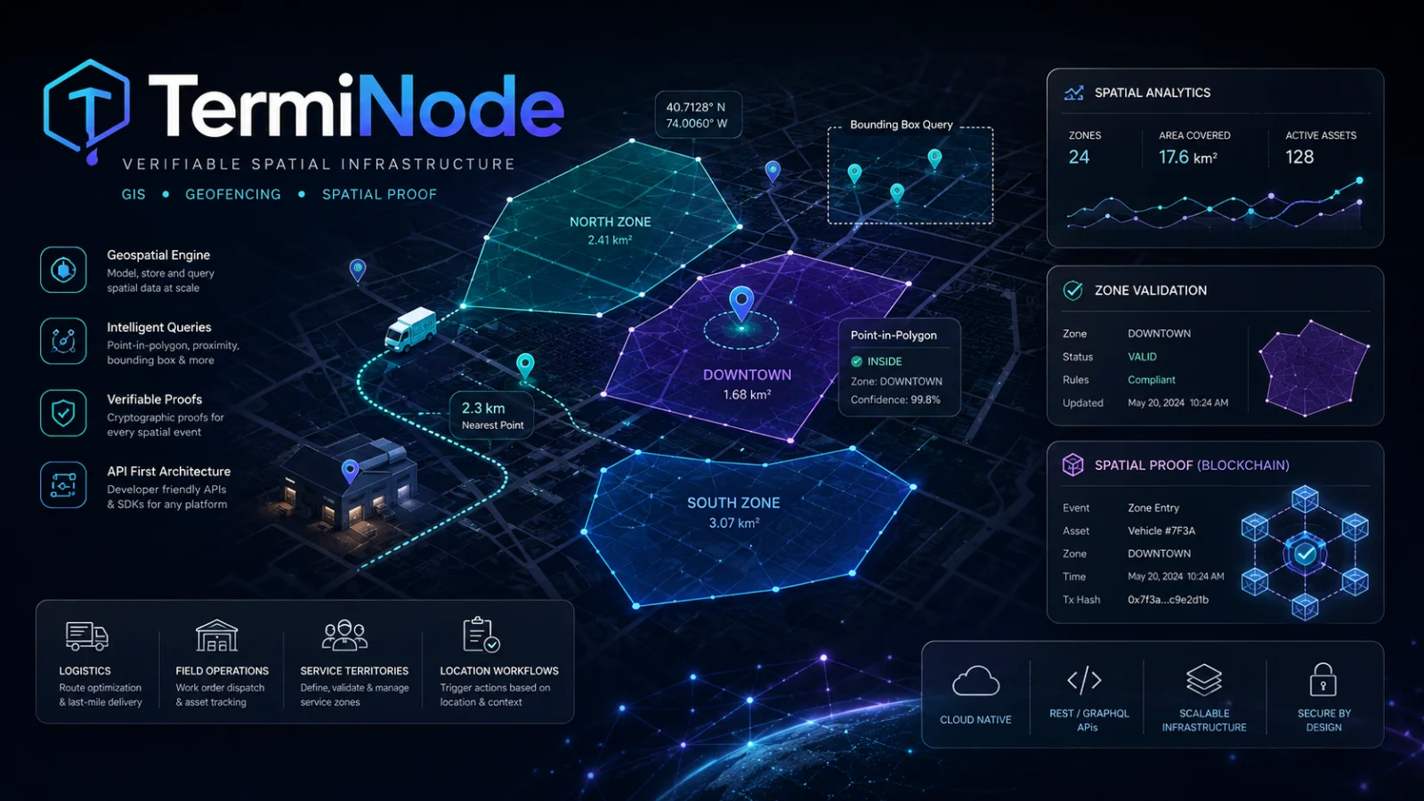
TermiNode is a GIS-first decentralized application I developed to explore a specific
problem in geospatial systems:
how can an important spatial record remain versioned, queryable,
auditable and independently verifiable after it changes?
Maps are often treated as presentation layers. In operational software, however,
geometry can become business logic.
A polygon may define a delivery zone, service territory, restricted area,
utility boundary, maintenance responsibility, insurance area or compliance region.
A point may represent a customer, vehicle, warehouse, incident or field technician.
Once business decisions depend on those spatial relationships,
GIS is no longer simply about displaying markers on a map.
The application must understand coordinate systems, geometry validity,
point-in-polygon decisions, spatial intersections, proximity,
version history, query performance, access boundaries and the operational meaning
of every spatial rule.
TermiNode demonstrates those concepts through a blockchain-based proof layer,
but the underlying expertise is intentionally broader:
the same spatial workflows can be implemented as
traditional Laravel/PostgreSQL/PostGIS applications,
API-first enterprise systems, mobile field platforms or hybrid architectures
depending on the actual business problem.
Blockchain Is an Architecture Choice — GIS Is the Domain
A location-based project does not automatically need blockchain.
In most business applications, customer records, dispatch screens,
routing, notifications, billing and high-volume operational data
are better handled by conventional application infrastructure.
Blockchain becomes useful when a subset of spatial state requires stronger provenance:
for example, when an accepted boundary must remain independently inspectable,
when previous geometry must not silently disappear,
or when multiple organizations need a shared evidence layer without relying entirely
on one party's mutable database.
Conventional GIS
Operational Application Layer
- Customer and order management
- Dispatch and assignment
- Routing and ETA calculations
- PostgreSQL / PostGIS
- High-volume location queries
- Private business data
- Dashboards and reporting
- Notifications and billing
Verifiable GIS
Proof and Accountability Layer
- Accepted spatial state
- Versioned geometry
- Audit events
- Proof receipts
- Snapshot checksums
- Evidence export
- Partner verification
- Dispute and compliance evidence
Understanding the Spatial Data Model
The first step in a GIS application is not choosing a map library.
It is identifying which business concepts are actually spatial
and which geometric representation describes them correctly.
| Geometry |
Business Example |
Typical Spatial Question |
|
Point
|
Customer, vehicle, warehouse, technician
|
Which zone contains this location?
|
|
Polygon
|
Delivery zone, service area, restricted region
|
Is this address eligible for service?
|
|
MultiPolygon
|
Non-contiguous franchise or delivery territory
|
Does this location belong to any part of the territory?
|
|
LineString
|
Route, pipeline, service corridor
|
Does this route intersect a restricted region?
|
|
Bounding Box
|
Current map viewport
|
Which records should be loaded for this screen?
|
GIS for Delivery Zones and Location-Based Commerce
One of the most commercially useful GIS patterns is service-area management.
A business may not serve every address under the same price,
delivery promise or operational team.
Instead of representing serviceability through city names or postal-code lists,
a GIS-enabled application can make the decision directly from geographic boundaries.
Delivery Eligibility
Convert a customer address into coordinates and determine whether
the point falls inside an active delivery polygon.
Zone-Based Pricing
Different spatial zones can define delivery fees,
minimum order values or commercial conditions.
SLA by Geography
Central, extended and remote service zones can carry
different delivery-time commitments.
Warehouse Assignment
A customer location can be mapped to the responsible warehouse,
hub or distribution center.
Restricted Delivery Areas
Special zones can prevent or flag deliveries where vehicles,
products or operations are restricted.
Territory Ownership
Sales representatives, dealers, franchises or operational teams
can be assigned to geographic territories.
Example: Location-Aware Order Allocation
The spatial decision should be made by the backend and persisted with the order.
Recalculating historical orders against today's delivery zones can otherwise produce
a different answer after boundaries change.
Why Geographic Boundaries Need Versioning
Spatial business rules change.
A delivery zone expands, a franchise territory is reassigned,
a restricted region changes or a service area is redrawn.
Overwriting the polygon answers the question
“what is the boundary today?”
but destroys the answer to
“which boundary was valid when this order or decision was made?”
Operational Versioning
A traditional GIS application can keep valid-from,
valid-to and geometry-version records in its spatial database.
Verifiable Versioning
Where stronger provenance is required, an accepted geometry version
can additionally receive an immutable proof and evidence record.
Logistics GIS Beyond Simple Route Maps
Route visualization is only one part of geospatial logistics.
Many valuable logistics decisions are spatial predicates executed before,
during or after route calculation.
| Workflow |
Spatial Logic |
Business Action |
|
Delivery eligibility
|
Point inside service polygon
|
Allow or reject checkout
|
|
Dispatch
|
Location inside operational territory
|
Assign hub, vehicle or team
|
|
Proximity
|
Nearest / distance query
|
Find closest warehouse or technician
|
|
Route compliance
|
Route intersects restricted polygon
|
Warn, reroute or require approval
|
|
Proof of arrival
|
Device inside destination geofence
|
Enable location-aware workflow event
|
|
Geographic pricing
|
Customer location mapped to tariff zone
|
Apply delivery or service fee
|
Geofencing Is More Than Latitude and Longitude
A production geofencing workflow must account for uncertainty.
Mobile GPS coordinates are measurements, not mathematically perfect positions.
Depending on the business risk, a system may need to evaluate GPS accuracy,
boundary tolerance, timestamp, device context and whether a location is exactly
on the edge of a polygon before triggering an irreversible workflow.
Conventional GIS Architecture With PostgreSQL and PostGIS
When blockchain proof is unnecessary, the same location-based workflows can be implemented
efficiently in a conventional application architecture.
For business applications, PostgreSQL with PostGIS provides a powerful foundation
for storing geometry and executing spatial queries close to the operational data
that depends on those relationships.
ST_Contains
Determine whether a delivery, customer or asset location
belongs to a defined polygon.
ST_Intersects
Detect overlapping areas or routes crossing controlled regions.
ST_DWithin
Search for nearby warehouses, technicians, customers or assets within a radius.
Spatial Indexes
GiST-backed spatial indexes make geographic filtering practical
for much larger datasets than application-side polygon loops.
GeoJSON APIs
Spatial features can be exposed through controlled APIs
to maps, mobile clients and external integrations.
Temporal Geometry
Version tables can preserve which polygon was operationally valid
at a particular point in time.
Coordinate Systems Matter
A common GIS mistake is treating every coordinate operation as if latitude and longitude
were ordinary Cartesian values.
EPSG:4326 is an effective interchange format for web and API workflows,
but distance, buffering and area calculations may require geography-aware calculations
or an appropriate projected coordinate reference system.
Choosing the wrong spatial model can produce technically valid queries with incorrect business results.
Bounded Spatial Queries Instead of Loading the Entire Map
Spatial applications should not send every feature to every client.
The application should normally request only the features relevant to the current viewport,
dataset or operational query.
Bounding Box
Retrieve features visible in the current geographic window.
Dataset Scope
Query only the spatial layer relevant to the workflow.
Pagination
Keep large spatial responses bounded and predictable.
Generalization
Reduce unnecessary geometry detail where the current zoom does not require it.
What TermiNode Adds: Verifiable Spatial State
TermiNode takes a deliberately narrow part of the wider GIS problem
and makes it independently inspectable.
Versioned Polygon State
Previous accepted geometry does not silently disappear after an update.
Bounded Spatial Reads
Dataset, bbox, point and paginated spatial queries expose controlled spatial context.
Audit Events
Important geometry changes can be reviewed through a persistent event trail.
Proof Receipts
High-value spatial checks can produce portable verification references.
Snapshot Checksums
Exported dataset state can carry evidence that helps later integrity review.
Evidence Export
Spatial state can leave the application as an inspectable evidence package.
Example Hybrid Architecture for a Logistics Platform
A logistics application rarely benefits from moving its entire workflow on-chain.
A stronger architecture keeps high-volume operational data in conventional systems
and selectively anchors spatial records where independent verification adds value.
| Domain |
Recommended Layer |
|
Orders
|
Laravel / ERP / conventional relational database
|
|
Customers & addresses
|
CRM / application database
|
|
Vehicles & drivers
|
Fleet-management database
|
|
Routing & ETA
|
Routing engine / external location API
|
|
Operational geofencing
|
PostgreSQL / PostGIS
|
|
Accepted regulated delivery zones
|
Conventional GIS + optional verifiable proof layer
|
|
Spatial audit evidence
|
TermiNode when independent proof is justified
|
Location-Based Workflows Across Industries
The same GIS architecture patterns apply far beyond a map-centric application.
Logistics & Last-Mile Delivery
Service zones, dispatch territories, restricted routes,
warehouse allocation and location-aware pricing.
Field Service
Assign technicians by territory, proximity,
service radius or infrastructure responsibility.
Wholesale & Distribution
Dealer regions, sales territories, regional pricing
and warehouse catchment areas.
Infrastructure
Asset corridors, inspection areas, maintenance zones
and responsibility boundaries.
Insurance
Claim boundaries, risk zones, event footprints
and spatial evidence packages.
Municipal & Utility
Service areas, outage regions, public works,
zoning and infrastructure boundaries.
GIS as an API Capability
A spatial system does not need to expose a map to provide GIS value.
Many of the most valuable spatial functions can operate as application services
consumed by CRM, ERP, e-commerce, logistics and mobile applications.
POST /serviceability
Can this customer location be served?
GET /zones/{location}
Which operational zones apply to this coordinate?
GET /nearest
Find the nearest eligible warehouse, technician or asset.
POST /route-check
Determine whether a planned route conflicts with a controlled area.
These services can be integrated into existing business applications
instead of forcing every team to operate a separate GIS product.
Agent-Readable Spatial Context
TermiNode also explores Model Context Protocol as a read-oriented interface
for spatial evidence.
An AI agent can inspect dataset, feature version, audit, snapshot and metrics context
without receiving unrestricted write authority.
The same principle can be applied to conventional GIS applications:
expose explicit spatial tools to an AI system instead of asking the model
to infer geographic truth from screenshots or raw database access.
Architecture Options for GIS Projects
| Requirement |
Possible Architecture |
|
Internal logistics system
|
Laravel + PostgreSQL/PostGIS + REST API
|
|
Mobile geofencing
|
Mobile location client + backend spatial verification
|
|
Customer-facing delivery map
|
PostGIS + GeoJSON + web map frontend
|
|
High-volume regional lookup
|
Indexed PostGIS queries + cache + bounded API
|
|
Shared spatial proof
|
Conventional GIS + TermiNode proof layer
|
|
Fully decentralized spatial product
|
ICP canisters + Candid + verifiable spatial records
|
GIS and Geospatial Development Scope
PostgreSQL / PostGIS
Spatial persistence, indexes, proximity, containment and intersection queries.
GeoJSON / WKB
Standard spatial interchange formats for APIs and GIS integration.
Spatial REST APIs
Serviceability, geofence, proximity and spatial-query interfaces.
Geofencing
Region-based workflow triggers and backend location validation.
Delivery & Service Zones
Polygon-based eligibility, pricing, SLA and assignment logic.
Location-Based Workflow Automation
Connect spatial decisions with CRM, ERP, order and field-service workflows.
Spatial Versioning
Preserve historical operational boundaries and effective periods.
Blockchain GIS
Selective proof layers for spatial state requiring stronger provenance.
Internet Computer / Candid
Decentralized application and canister-based spatial service architecture.
MCP / Agent Integration
Structured read interfaces for AI-assisted spatial review.
Building Location-Aware Business Applications
TermiNode is a deliberately specialized DApp,
but the engineering knowledge behind it applies directly to conventional business software.
If an order, customer, vehicle, technician, asset or business rule depends on
where something is located,
a spatial data model can often replace fragile city-name rules,
manually maintained postcode tables and application-side distance calculations.
I can design the spatial layer as part of a conventional CRM, ERP,
logistics or field-service platform using PostgreSQL/PostGIS and APIs,
or introduce a blockchain-based proof layer where versioned geometry,
independent verification and durable evidence provide genuine business value.
The architecture should follow the operational requirement —
not force every location-based problem into either a blockchain product
or a generic map application.
Architecture note:
TermiNode is intentionally positioned as a verifiable spatial proof layer,
not as a replacement for mature GIS authoring, routing, basemap, search or field-work platforms.
Conventional databases and GIS services should continue to handle high-volume,
private and operational application state where they are the better technical fit.